
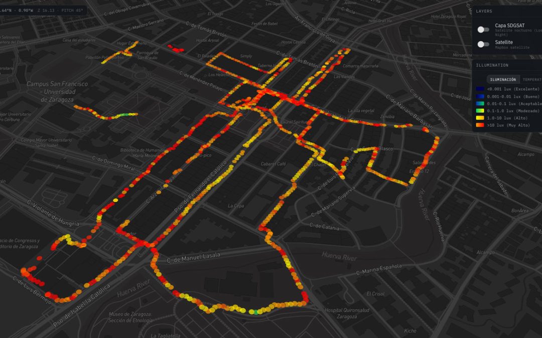
Artificial Light at Night (ALAN) is increasingly recognized as a pervasive environmental stressor that fragments nocturnal habitats, disrupts species behaviors, and alters terrestrial ecosystems across Europe. To understand where light pollution transitions from urban glow to ecological stress, the PLAN-B project is deploying citizen science methodologies that empower local communities to map night skies at ground level.
Led by Fundación Ibercivis under PLAN-B’s Task 6.3, the project has launched specialized measurement campaigns across the city of Zaragoza (Spain), as one of the project’s pilot regions. By combining portable sensing technology with the open-access visualization platform Open-red.es, participants are transforming how night-time environmental data is collected, visualized, and analyzed.
High-Precision Sensing Meets Seamless Data Collection
To capture ground-level light pollution with scientific rigor, Ibercivis acquired a fleet of approximately 30 portable, high-precision luxometers. Unlike static monitoring stations, these handheld devices allow citizen scientists, astrophotographers, local students, and environmental groups to conduct mobile field surveys along urban-to-periurban gradients.
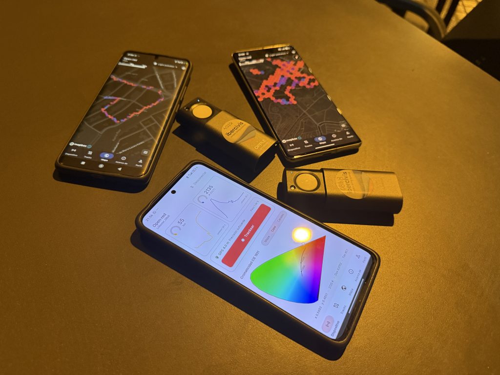
The core innovation of the campaign lies in its seamless technology integration:
- Automatic Bluetooth Pairing: The luxometer connects wirelessly via Bluetooth to a dedicated mobile application integrated with the Openred platform.
- Real-Time Track Recording: As volunteers walk their pre-planned routes—transitioning from brightly lit city centers out toward parks, riverbanks, or natural reserves—the app continuously pairs real-time lux readings with precise smartphone GPS coordinates.
- Zero Manual Friction: Participants no longer need to manually record illuminance levels or coordinates, allowing them to focus on observing environmental conditions and identifying lighting infrastructure.
Visualizing the Night Sky on Open-Red.es
Once a measurement walk (track) is completed, the recorded dataset is automatically uploaded to the Openred visualization platform (open-red.es).
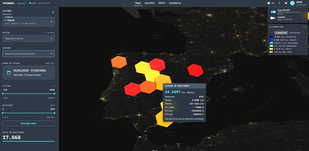
Openred compiles these crowd-sourced transects into interactive heatmaps and spatial profiles. This allows scientists, municipal lighting engineers, and the public to:
- Analyze Decay Curves: Examine exactly how fast artificial light levels drop off as one moves away from urban centers into surrounding ecosystems.
- Complement Fixed Stations: Fill critical spatial gaps between official fixed environmental monitoring stations with high-resolution, street-level measurements.
- Open Access Data: Ensure that all collected environmental data remains freely accessible to researchers, policymakers, and civil society.
In preliminary field campaigns conducted across pilot locations—including Zaragoza, Madrid, and Granada (Spain), Gdańsk (Poland), and Oulu (Finland)—citizen scientists have already contributed over 5,000 individual light measurements to the Openred database.
Bridging Space and Ground Data: High-Resolution Satellite Overlay on Openred
Furthermore, one of the most prominent developments on the Openred platform is the capability to overlay the SDGSAT layer, which provides high-resolution nighttime satellite imagery of cities. This functionality allows for direct comparison and correlation of ground-based data collected by citizen scientists with space-measured radiance. The access to and integration of these satellite images constitutes a fundamental milestone of the PLAN-B project, and the ability to overlay both layers represents a substantial research breakthrough by providing precise cross-validation between spaceborne observations and quantitative street-level measurements.
Empowering Communities of Practice (CoPs)
Beyond collecting data, these measurement walks serve as the foundational catalyst for establishing local **Communities of Practice (CoPs)**. Supported by step-by-step user manuals, adaptation of Citizen Observers engagement protocols, and educational guides from the Cities at Night project, local groups can now organize and execute their own night walks independently.
From assessing amphibian habitats in Gdańsk during the Frog 2025 campaign to mapping nocturnal gradients near Zaragoza’s natural riverbanks, these citizen-led efforts demonstrate that protecting dark skies begins at the street level—one track at a time.