The European Light Pollution Manifesto
The European Light Pollution Manifesto

Tackling noise and light pollution
for a Sustainable Tomorrow
The Path Towards Addressing Adverse Impacts of Light and Noise Pollution
on Terrestrial Biodiversity and Ecosystems
Our PLAN-B latest news
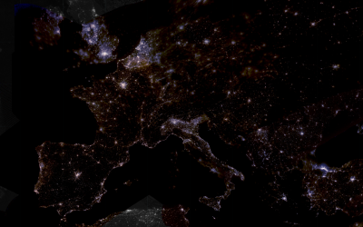
Europe at night from space
Europe shines brightly at night, as seen in this mosaic created from over 7000 pictures taken by astronauts on the International Space Station. This is the first nighttime mosaic of Europe in colour ever produced with calibrated space images. The composition...
PLAN-B in the The International Conference on Light Pollution and Dark Sky Protection – Enlight 2025
We’re proud to share that the PLAN-B project was featured at the ENLIGHT International Conference on Light Pollution and Dark Sky Protection, held in Novi Sad, Serbia, from 28–30 November 2025. Representing PLAN-B, Yana Yakushina took the stage with a powerful...
Watch the Workshop: Noise Pollution & Biodiversity — An INITIATIVE by PLAN‑B 🌍
The recent online workshop hosted by PLAN‑B — “Noise Pollution & Biodiversity” — is now available for viewing, and it’s a must‑see for anyone interested in environmental science, policy and conservation. The session was originally held on 26 November 2025, aimed...
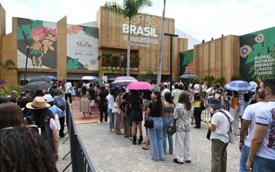
PLAN-B in the #COP30 Meet us and help RESTORING THE NIGHT!
How can we protect the night? The “Restoring the Night” panel takes place at the Casa da Biodiversidade e Clima, the parallel space of Brazilian states at COP30 in Belem, bringing together international experts to address light pollution and restore nighttime...
Online Workshop on Noise Pollution & Biodiversity
Join the PLAN-B Online Workshop on Noise Pollution & Biodiversity! PLAN-B will host an online workshop dedicated to noise pollution, its ecological impacts, and the upcoming Noise Pollution Policy Brief on Wednesday, 26...
PLAN-B Survey on social and psychological drivers of pollution
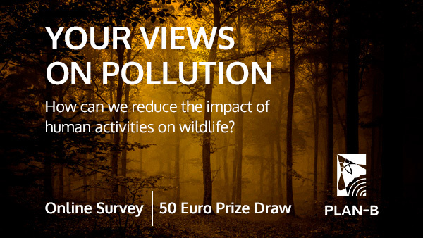
We invite you to take part in our online survey. We want to better understand your views on light and noise pollution. Survey Why are we doing this survey? The societal context of noise and light pollution is an important part of PLAN-B. Given that human activities...
PLAN-B in the On Light o’ clock Podcast
Karolina Zielińska-Dąbkowska, researcher from Gdansk Tech and one of our PLAN-B Researchers and work package leaders, has recently participated in the On Light o’ clock Podcast to share her scientific insights to tackle the effects of light pollution. On Light o’...
PLAN-B Research in Split: Raúl Pérez Parras Presents Key Advances in Automated Georeferencing of Nighttime ISS Images
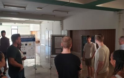
The PLAN-B project continues to expand its horizons and strengthen its international presence. Last week, our colleague Raúl represented the team at the 10th SPLIT REMOTE SENSING HANDS-ON PROFESSIONAL SUMMER SCHOOL, held in Split (Croatia), a leading event in the...
PLAN-B Upcoming Events & Activities
PLAN-B Survey on social and psychological drivers of pollution
Help us reach 1,000 responses!
Share your perception of light and noise pollution with us.

PLAN-B is an EU funded (Horizon Europe) project that aims to create the enabling conditions to support the activities planned in the EU Biodiversity Strategy for 2030, and provide new paths to tackle light and noise pollution in European ecosystems, according to the EU and international biodiversity targets.

4 years project

8 countries involved

12 consortium members

2.4M € Funding
Our PLAN-B Key Outputs
Knowledge Database
An open-access database on light and noise impacts on terrestrial biodiversity and ecosystem services.
New Scientific Models and Maps
Spatiotemporal models for evaluating noise and light impacts on the terrestrial environment, along with light and noise pollution maps of Europe.
Communities of Practice (CoPs)
Sustainable CoPs, focused on key stakeholder groups, addressing the impacts of light and noise on terrestrial biodiversity and ecosystem services.
Policy Briefs
Recommendations for strengthening legal and policy frameworks to reduce the impacts of light and noise pollution on terrestrial biodiversity and improve decision-making.
Handbook of Solutions
A compendium of established and innovative regulatory, social, environmental, planning, and technological solutions to mitigate light and noise pollution impacts.
Synthesis Report
A report on the current state and future trajectory of light and noise pollution impacts across Europe.
Join the PLAN-B Newsletter
The PLAN-B project newsletter shares with you the latest news about our project and its scientific activity, focused on tackling light and noise pollution in European ecosystems, together with new developments in evidence-based regulation.
Get involved!

The Lost At Night application is designed to help georeference images taken by astronauts aboard the International Space Station (ISS).
The goal is to create a global map of Earth’s lights at night to measure and track light pollution. By accurately aligning images with geographical coordinates, the app contributes to valuable environmental data collection, which can be used for scientific research, monitoring light pollution, and understanding its impact on ecosystems and human health.
Lost At Night is an iniciative of the PLAN-B Project that uses citizen science methodologies to involve researchers, activists, enthusiasts and general public in tackling light and noise pollution across Europe. This application already brings up to date the previous ten years of work of the Cities At Night project.

Be part of the PLAN-B Community!
We invite you to take part in PLAN-B‘s activities and build a network of initiatives, researchers, activists, enthusiasts and the general public who want to contribute to tackling light and noise pollution in European ecosystems.
You will be able to participate in citizen science campaigns in the pilot areas of Gdansk (Poland), Leipzig (Germany), Belo Horizonte (Bazil) and Zaragoza (Spain), contribute to the mapping of the night sky with the Lost At Night app and take part in clustering events and dissemination of results together with sister projects, citizen groups and scientific associations.
